
18.1 Where do Deserts Occur?
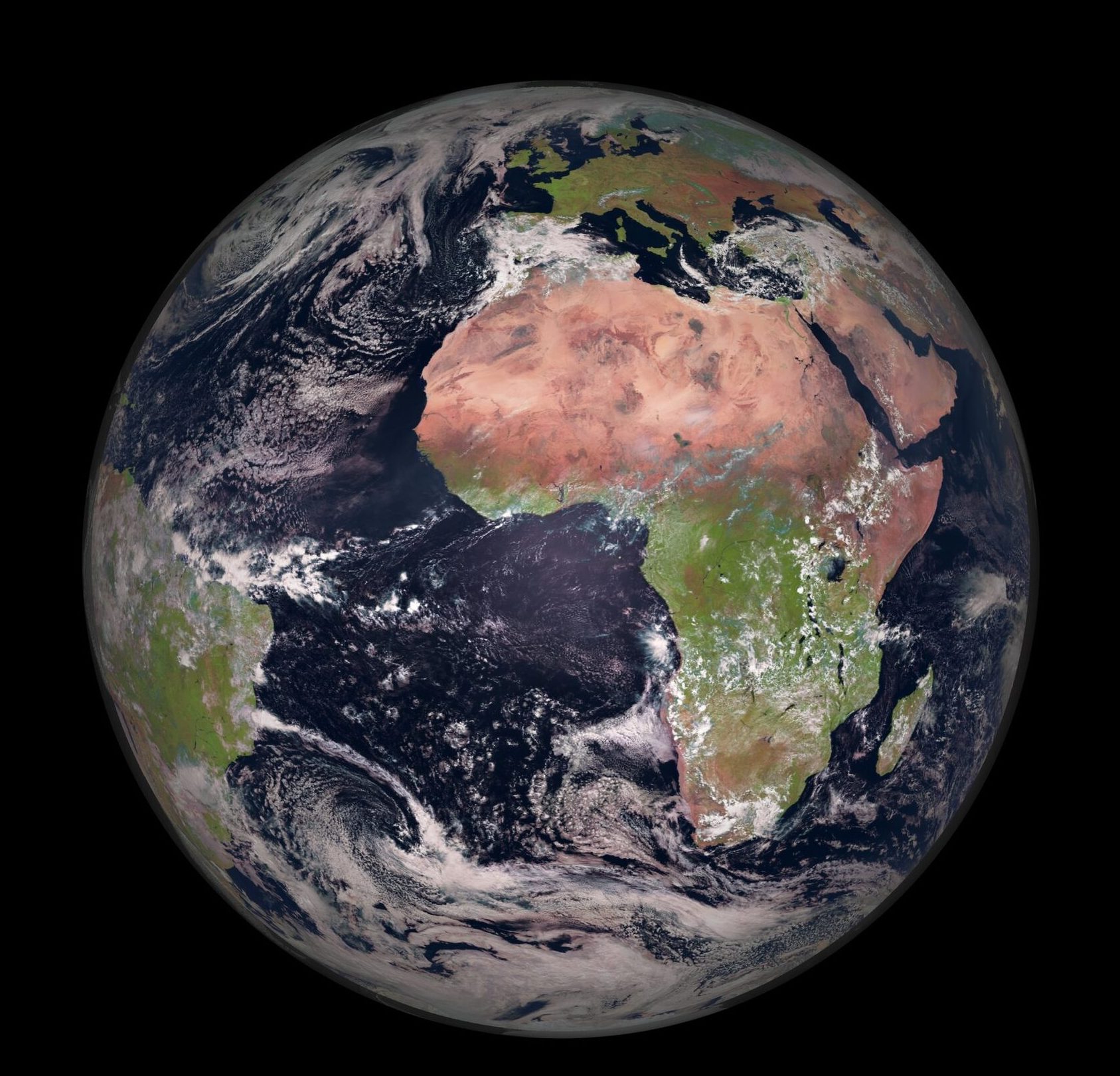
If you look at an image of earth from space such as this one above, or better yet, play around on GoogleEarth, you’ll notice that there are regions of vibrant green vegetation, and other areas of dry barren land that seem to stripe across the globe in horizontal lines. The continent of Africa is the best place to see this as it is large and has significant land mass across the equator, but the pattern of dry and wet land that you see in Africa extends globally. Dry desert regions exist along the tropics of Cancer and Capricorn, clearly visible from space in the Sahara desert of Northern Africa, the dry Arabian peninsula, and the continent of Australia. Wet rainforests of dense vegetation exist along the equator in the jungles of the congo, the Amazon rainforest, and Indonesia and Malaysia in southeast Asia.
The cause of these deserts and rainforests is the same. Moisture is systematically transferred from these dry regions to the equator and then dumped out in the form of rain. A look at our global atmospheric circulation patterns will show how.
Global Atmospheric Circulation and Deserts
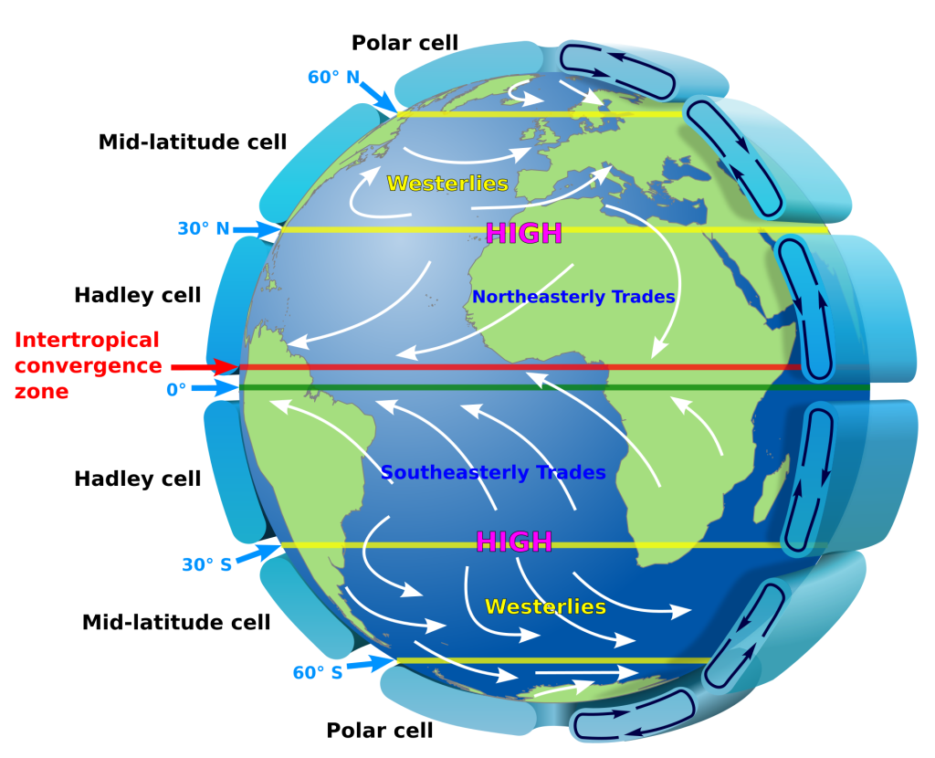
As you may recall from Chapter 15, warm and cool air circulate in our atmosphere in large ‘convection cells’ that help explain many global weather and climate patterns. Near the equator warm moist air rises, and around 30° north and south of the equator cool dry air sinks back to Earth’s surface. These patterns of convection are called circulation cells, and the ones on either side of the equator are called ‘Hadley Cells.’ The portion of this convection that runs along Earth’s surface is what we think of as wind, and you can see from the diagrams that the dominant wind directions between 30°N and 30°S is towards the equator.
Wind moving along earth picks up moisture via evaporation. As warm moisture-laden air approaches the equator it rises and carries that moisture up to cooler temperatures higher in the atmosphere. As the water vapor rises and cools it begins to condense into liquid water and gravity pulls those raindrops right back down onto the equator. The area where the two Hadley Cells meet is called the Intertropical Convergence Zone (ITCZ) and is known for extremely heavy rainfall.
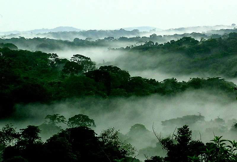
The Congo is one of many wet rainforests that occur along the equator. It averages as much as 2,000 mm of rain in a year (Britannica).
The Saharan desert is Earth’s third largest desert after Antarctica and the Arctic and covers the width of North Africa. It averages just 76 mm of rainfall each year (Britannica)
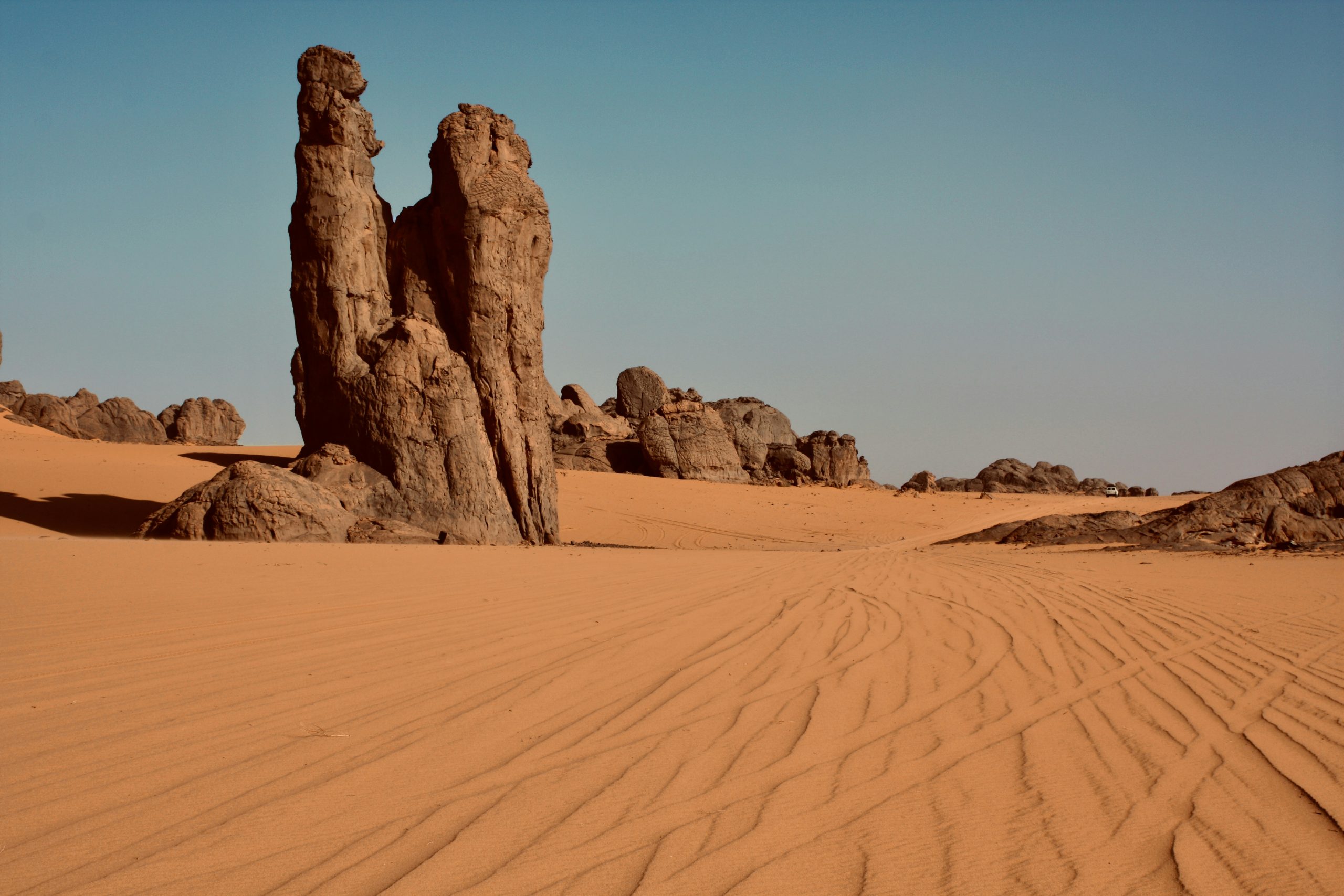
Having lost its moisture in the form of rain, air at the equator then cycles away to the other side of the Hadley Cell at the Tropic of Cancer in the north and Tropic of Capricorn in the south. It warms as it sinks to the Earth’s surface and this warm dry air thirstily evaporates any moisture it can on its way back to the equator where it will once again rise, cool, and rain out all of the moisture that it sucked up from drier regions. Moisture is constantly carried from dry areas like the Namib Desert (Image 1) and Sahara (Image 4), to the Congo (Image 3) by this process.
A similar process happens at the edges of the other circulation cells resulting in wetter rainier climates around 60° north and south, and dry climates of low precipitation at the poles.
Localized Causes of Deserts
Rainshadow Effect
Global atmospheric circulation patterns are a significant driver of climate that result in deserts, but deserts can also occur due to the way that wind and moisture move across topography.
Someone living in the PNW has surely experienced the drastic change in climate that occurs when crossing the Cascades. On the western flank of the Cascades there is lots of precipitation, dense green foliage and vibrant mosses, while on the eastern side of the cascades the climate is much drier with less soil development and sparse vegetation.
The process that causes this phenomenon is commonly referred to as the ‘Orographic Effect’ or ‘Rainshadow Effect.’ Air moving across the ocean to the west evaporates moisture off of the surface and carries that moisture across the landscape towards cascades. As the wind pushes across the Cascades, the mountains act as a ramp, forcing the air up and over. Just as air in the Hadley Cell cools as it rises at the equator, this air from the west cools as it rises up the mountains, causing water vapor in the air to condense and precipitate out. This results in heavy rainfall on the western side of the Cascades where water vapor in the air is rising, cooling, condensing and raining out.
Once the air crosses the crest of the mountains, the air has lost most of its moisture as precipitation, and dry air warms as it sinks down the eastern side of the Cascades resulting in an arid desert climate.
Image
The rainshadow effect can be seen almost anywhere that has a large source of water and steep topography. Figure 4 below shows several examples of the Rainshadow effect around the world. In these cases and more, an arid region develops on one side of the mountains and a lush vegetated area sits on the other, due to moisture dropping out of the air as rain when wind pushes up the mountain.
Coastal Deserts
Somewhat unintuitively, oceans can be a cause of deserts as well as a source of moisture. Ocean currents circulate in large ‘gyres’ that sweep cold water from the poles towards the equator where it is warmed and then circulated back towards the poles. When warm moisture-bearing air rides over top of the cold ocean currents the warm air is cooled and water vapor in the air condenses and rains out. If the wind then blows this air towards the land the air will be dry and thirsty, warming as it moves over warmer land, and evaporating up any moisture it can find there, resulting in a coastal desert.
The Atacama Desert in South America and the Namib Desert in South Western Africa are both coastal deserts caused (in part) by cold ocean currents that run along the coasts.
